Application Examples
• Some applications for Landsat and SPOT imagery processed by PANCROMA:
• 3D terrain models from satellite imagery or topographical maps combined with DEM data
• 3D stereo anaglyph terrain models
• 3D stereo anaglyph terrain model animations
More examples see: Terrain Models of Israel
More examples see: Old Crow Models
More examples see: Old Crow Models 2
More examples see: Old Crow Models 3
More examples see: Old Crow Models 4
![[ Click to enlarge.]](img/NE Corner sm.jpg) Satellite Image Overlay - Panamint Range, California USA.
Satellite Image Overlay - Panamint Range, California USA.
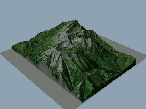
![[ Click to enlarge.]](img/TimpLargesm.jpg) Satellite Image Overlay - Timpanogos, Utah USA.
Satellite Image Overlay - Timpanogos, Utah USA.
 3D Animation
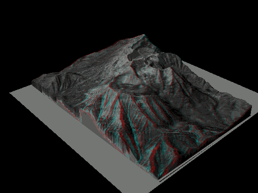
![[ Click to enlarge.]](img/TimpAnasm.jpg) 3D Anaglyph Image (OO/ Red/Blue glasses needed)
3D Anaglyph Image (OO/ Red/Blue glasses needed)
 3D Anaglyph Animation (OO Red/Blue glasses needed)
Landsat imagery courtesy of NASA Goddard Space Flight Center and U.S. Geological Survey. 3D Overlays made using 3DEM
Web site and all contents © Copyright TERRAINMAP Earth Imaging LLC 2010, All rights reserved.
www.PANCROMA.com
3D Anaglyph Animation (OO Red/Blue glasses needed)
Landsat imagery courtesy of NASA Goddard Space Flight Center and U.S. Geological Survey. 3D Overlays made using 3DEM
Web site and all contents © Copyright TERRAINMAP Earth Imaging LLC 2010, All rights reserved.
www.PANCROMA.com

![[ Click to enlarge.]](img/NE Corner 50.jpg)
![[ Click to enlarge.]](img/TimpLarge.jpg)
![[ Click to enlarge.]](img/TimpAna.jpg)